La Petite Reine, des Alpes Mancelles au Saosnois
Chérancé
30 Rue de la Gare
72170 Chérancé130 kilometers - I cycle often.
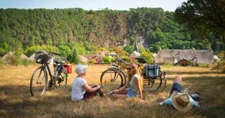
This rural cycling trip takes you from the Alpes Mancelles to the Perseigne forest, passing through picturesque villages. The cycling loop is a bucolic variant of La Vélobuissonnière from the east.
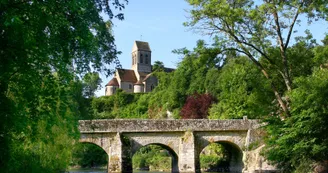
Saddle up in Alençon, a UNESCO-listed city renowned for its lace, and take the small roads that lead you through the heart of the Normandy bocage and then across the Alpes Mancelles. The cliffs overhanging the Sarthe river are reminiscent of mountain landscapes. Enjoy a stopover in one of the "Petites Cités de Caractère" (small towns of character) in this area. Then continue on towards Beaumont-sur-Sarthe to Chérancé. Here begins a 17km greenway leading to Mamers. Take the time to discover the rich heritage of the town and taste the famous rillettes made by local craftsmen. Rejuvenated before taking the small roads that will lead you to the heart of the Forêt domaniale de Perseigne, the highest point of the Sarthe with its belvedere. On the way to Alençon, a pilgrimage to the Musée du Vélo "La Belle Echappée" is essential to conclude your escapade on the route of "La Petite Reine"!
Find this route on the Loopi mobile app
Scan the QR code, save it as a favorite, or start the guidance, just enjoy!
Scan the QR code, save it as a favorite, or start the guidance, just enjoy!
This route is provided by: SARTHE TOURISME
Be cautious and prepared during your outings. Loopi and the author of this sheet cannot be held responsible for any problems that occur on this route.

